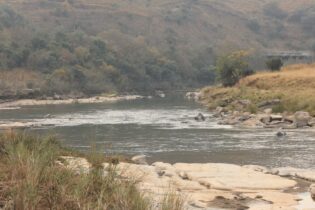
The development of a groundwater monitoring network and aquifer characterisation of the greater Mbazwane area of KwaZulu-Natal involved the application of good hydreological principals, Jeffares& Green executive associate Mark Schapers tells Chantelle Mattheus.
The Department of Water Affairs (DWA), in conjunction with the University of Zululand commissioned the development of a number of geohydrologically strategic positions, focusing on the Sodwana to Lake Sibayi region. “The University of Zululand was trying to develop the monitoring network in Maputaland, KwaZulu-Natal, in conjunction with the South African Environmental Observation Network (SAEON). Eight areas were identified throughout central and northern KwaZulu-Natal where an increase in groundwater monitoring coverage is desired,” explains Schapers. The monitoring boreholes were aimed at identifying and determining the geohydrological characteristics of primary aquifers located in the central portion of the KwaZulu-Natal Coastal plain, to refine the numerical groundwater model being developed by Prof Bruce Kelbe of the University of Zululand. In addition, Schapers adds that the site work element of the proposal offered an opportunity for training DWA graduate staff members in geophysical surveying methods, borehole drilling supervision and potentially test pumping supervision. Site specifics Jeffares&Green was appointed on an existing term contract with the department, due to its extensive knowledge of the area gained when developing production boreholes for the Kwangwenase and Enkanyeziniwater supply schemes to directly to the north of the project area. “The terms of reference for this project are to establish eight boreholes, one at each of the locations. Six of these boreholes will be installed as groundwater monitoring installations and two as groundwater supply boreholes. The aim is to expand the groundwater monitoring network across the project area and to provide groundwater supply to two communities,” says Schapers. Drilling was conducted by Kwa-Natal Drilling using the Rotary Mud Flush drilling method. Two predominant aquifers were targeted, namely the shallow “sugar sands” of the Kwambonambi formation, and the deep semi-confined Uloa formation. Multiple installations targeting both aquifers were implemented at several locations.
Aquifer characteristics were determined through test pumping (conducted by AB Pumps), and respective interaction between the deep and shallow aquifer measured where possible.
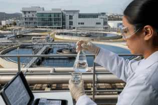
Water quality sampling was undertaken to establish geochemical signatures of the respective aquifers. Challenges conquered Time frames were one of the challenges the team had to overcome on the project, as the project had to be completed in a very small window. “Good subcontractors and determined project management realised the completion of the project on time and within budget. The scope was clear but limited technical detail, and the budget was utilised in the best manner to give the client a value-added product,” says Schapers. “Several of the holes were drilled within the iSimangaliso Wetland Park, and standard procedures and environmental controls had to be adjusted to conform to stringent codes of conduct in order to minimise the environmental impact on the whole,” says Schapers. As a result, close liaison with the iSimangaliso Park Authority was required and all implementation was conducted in the presence of an environmental control officer in accordance with a strict management plan. Sustainable impact Two of the monitoring positions were developed with the view to upgrade the boreholes to production status to help with community development, a need which was rapidly confirmed by opportunistic water collection by the surrounding communities in those areas. According to Schapers, rural communities, industry, and municipalities on the Coastal Flats rely on groundwater as a major source of potable water for domestic consumption. Many schemes are solely dependent on groundwater; however, they are developed in isolation and often involve limited or no groundwater monitoring, poor pumping practice, and even indiscriminate abuse. Increased forestry – much of it unlicensed – is a major generator of income in a predominantly poor rural setting, but it also has a severe potential impact on the shallow groundwater condition, and associated sensitive ecological environments. “Additionally, a large portion of the flats is a world heritage site where little or no technical data on groundwater aquifers is available,” says Schapers. “The results of the longer term monitoring of these boreholes will be used to develop a groundwater model for the flats, quantify broader aquifer characteristics, and optimise potential and sustainable use of the groundwater reserve in a broader context from both a direct consumptive perspective, as well as sustainable forestry. Communities will benefit because they will be able to sustainably maximise the use thereof,” concludes Schapers.