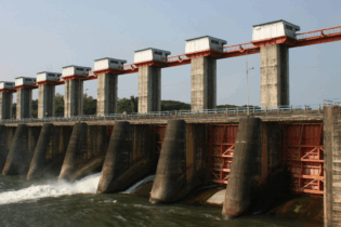
The Department of Water Affairs (DWA) in the Western Cape Region is calling on residents and people engaged in assortment of activities near dams to be cautious as dams, canals and reservoirs in the province are at full capacity due to the persistent heavy rains.
This is according to a statement released by the Department on Friday 30 August, which added that “he soil in the Western Cape is saturated due to high rainfall and will result in a high runoff which could cause excessive flooding in low areas.” According to the Department, people who stay within the 1:100 year flood lines are especially advised to be on the alert The Department met with the Provincial Disaster Management Centre (PDMC) on Thursday 29 August to discuss the disaster risks associated with the dams in the province. The average capacity of Western Cape dams is currently at 102.35% full. The risk areas with a high possibility have been identified as: • Eerster River system (Residential and Agricultural areas in the flood planes); • The Lourens River at Somerset-West (low lying residential areas); • The confluence of the Olifants and Doring Rivers downstream of theClanwilliam dam close to Vredendal (Residential and Agricultural areas in
the flood planes); • Kingna and Keisies River (Montagu and surrounding areas); • Berg River at the Paarl downstream of Berg River dam (Residential area in the flood plane of the river); and • Wolwedans dam (Mitigation measures are to breach the Great Brak Estuary. “The Region is currently on alert and closely observing the specific areas of concern. The level of the dams is also under constant monitoring by means of real time monitoring systems,” reported the Department, withthe Berg River at Paarl experiencing a localised flooding which affected nearby informal settlements at the time of the statement. “Members of the public are also reminded to contact our call centre on 0800 200 200 for reporting any water related emergencies and concerns.”


