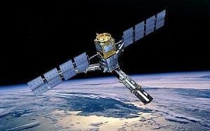
The Egyptian government plans to use satellite technology for the development and monitoring of underground water and coastal regions endangered by climate change.
However, this rests on the availability of expertise and adequate financial resources to finance Egypt’s space program, Al-Monitor reported. The Egyptian Space Agency will contribution to development in water, the environment, agriculture, industry, mining, urban planning, and the early detection of natural hazards. Egypt launched its EgyptSat 2 satellite in Russia on 14 April. The head of Egypt’s National Authority for Remote Sensing and Space Sciences, Medhat Mokhtar, told Al-Monitor the satellite will primarily focus on three main issues. These are the conclusion of studies to develop the Suez Canal axis, the monitoring of the Renaissance Dam’s effects on the water security of Egypt,and the development of projects for the south eastern region of Egypt.“Studying the effects of the Renaissance Dam on Egypt is the most important issue for the Authority for Remote Sensing right now. The new satellite’s imagery is expected to yield data and information pertaining to the dam’s design and the volume of water that it will trap, to determine the flow rate of water to Egypt and the direct impact on the valley and the Delta,” said Mokhtar.
Egypt plans to launch another satellite, EgyptSat 3, in early 2016. 60% of it will be made in Egypt with financial assistance from China.


