Transport World Africa learns more about the N1 corridor, discovering the challenges and opportunities it presents to transporters and logistics service providers.
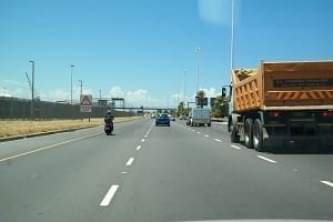
Running through the Western Cape, the N1 cuts across the south-eastern corner of the Northern Cape, enters and exits the Free State, crosses into Gauteng and, finally, ends up in Limpopo. “A primary consideration for drivers on the N1 route is long-distance fatigue, as the corridor traverses large areas of arid Karoo landscape. Most drivers are not interested in the geographical history of the area and, therefore, become easily bored. Distance and speed perceptions are reduced at night, particularly when drivers are already fatigued,” says Johann Olivier, operations director, Integrated Transport Industry Solutions. Stationary trucks are a frequent hazard since drivers often choose to sleep roadside, thereby saving on parking fees. The route has a finite number of safe, clean overnight rest points. Trucks also frequently break down, particularly in the summer months when ambient temperatures exceed 40°C. Part of the route travels through the Huguenot Tunnel. Accidents here pose a severe danger to other road users, sometimes forcing commercial vehicles to use the dangerous and lengthy Du Toit’s Kloof pass or wait for the accident to be cleared. Depending on the nature of the incident, accident delays can last for several days, especially if a fire breaks out in the tunnel.“A primary consideration for drivers on the N1 route is long-distance fatigue.”
As eluded to earlier, there are few truck stops with adequate comfort and security facilities. Popular stops are found in Cape Town, Beaufort West, Colesberg, Bloemfontein, Johannesburg and Polokwane, with smaller refuelling facilities outside main urban areas. Mechanical and technical support are only really provided in Beaufort West and Colesberg, with refuelling and minor technical support available at smaller locations. The N1 route travels through the Hex River Valley, a spectacularly beautiful area with towering mountains. While there are numerous small towns accessible from the N1, there are few facilities for commercial vehicles and the locals do not always appreciate heavy goods trucks entering their otherwise peaceful locales. The unique geological history of the Karoo means it consists of vast open plains as far as the eye can see, resulting in long stretches of straight road bereft of any real distinguishing features. Drivers, therefore, prefer to get through these areas as quickly as possible. The Free State provides similar geography to the Karoo but differs greatly in agricultural activity. It is just as flat and featureless, although the road surface is generally in better condition, with longer stretches of dual carriageway, which assists overtaking. The Free State section passes through Bloemfontein, where adequate truck stops offer refreshments, opportunities for relaxation and full technical and mechanical support. Again, elevated temperatures often result in breakdowns and stationary trucks on the side of the road. High wind loadings are often encountered on this stretch of the route, and many vehicles get blown over. Gauteng is highly industrialised and developed and is, in most cases, the end destination for long-haul trucks departing Cape Town. Adequate road infrastructure allows for traffic to divert off the N1 route to various destinations, particularly to the east, towards the province’s large-scale industrial and commercial developments. While the province frequently plays host to spectacular late-afternoon thunderstorms, these are often accompanied by heavy rains and hail, capable of causing severe damage to vehicles and making the tarred roads precarious. Gauteng is also the meeting point of the N3 from Durban and, as a result, large quantities of import and export goods are moved from here to and from SADC countries up north. This means increased traffic volumes towards Musina and the infamously congested Beitbridge border into Zimbabwe, where the N1 route officially terminates. Volumes Traffic volumes on the N1 corridor are lower than they are on the N3 route between Durban and Johannesburg. Heavy-vehicle volumes on the N1 are not such that they create traffic problems for other road users, unlike the N3, as the much longer distance of the N1 means traffic is more evenly spread. However, seasonal patterns, especially during the citrus harvesting periods in the Western Cape, impact significantly on heavy-vehicle traffic volumes. This is the time when road transport logistics companies consider using rail. Traffic along the N1 route varies widely, with the South African National Roads Agency Limited (Sanral) measuring traffic volumes at a number of traffic counting stations including the Vaal, Verkeerdevlei, Grasmere and Huguenot. The approximate average daily traffic at the Vaal Plaza is 8 447 vehicles, 7 588 at Verkeerdevlei, 15 144 at the Grasmere Plaza and 11 889 vehicles at Huguenot. The approximate average daily traffic for freight or heavy goods vehicles is 1 631 at the Vaal Plaza (19.3%), 2 364 at Verkeerdevlei (31.1%), 1 750 at the Grasmere Plaza (11.5%) and 2 140 at Huguenot (18%). Peak traffic periods vary, not only between sections, but also for school holidays, seasonal fluctuations and different days of the week. On average, the peak period for heavy goods vehicles at the Vaal Plaza is approximately between 16:00 and 17:00, with an outlier of 14:00 on Tuesdays. Verkeerdevlei Plaza’s heavy-goods-vehicle traffic peaks, on average, between approximately 14:00 and 15:00, with the exception of 13:00 on Saturdays. At the Grasmere Plaza, the peak period for freight vehicles is, on average, approximately 16:00 on weekdays, 10:00 on Saturdays and 15:00 on Sundays. At the Huguenot Plaza, heavy-goods-vehicle traffic peaks, on average, between approximately 09:00 and 10:00, with the exception of 16:00 to 17:00 on Fridays and Sundays.Dealing with the peak transport challenge means:
• extended transport working hours and distances• extended dispatch and receiving operating hours
• hot-seat drivers for continuous capacity
• relocation capacity from other regions
• leveraging other inflows (e.g. from Eastern Cape)
• rerouting empty vehicles (e.g. from Eastern Cape)
• accepting empty legs to handle priority shipments
• supplementing with intermodal capacity. Maintenance N1 law enforcement is not a Sanral function and is handled by the provinces and local authorities. “At certain sections, Sanral provides intelligent transport systems, which include traffic monitoring with the use of cameras. This is for, among others, incident and crash detection. It also enhances safety for road users and serves to monitor operating conditions,” says Vusi Mona, GM: Communications, Sanral. Routine road maintenance is continuously carried out. “These activities include the repair of potholes, sealing cracks, guardrail repair, vegetation control and clearing drainage structures. This is part of the preventative maintenance measures. As and when necessary, subject to budget availability and where economically feasible, road infrastructure capital works to prolong pavement life is undertaken. Sanral monitors traffic and pavement conditions,” he adds.
“Managing demand provides significant opportunity for logistics service providers.”
A Transport Development Index (TDI), developed by Transport for Cape Town (TCT), established that the direct transport cost (fuel, salaries, maintenance and repairs, toll fees, etc.) for the freight user group is R1.755 billion per annum. It says the cost of congestion for this user group is around R121 million per annum and the cost of safety is R19 million per annum. The cost of crime is said to be in the region of R15 million per annum, with the impact of freight transporters on Cape Town’s residents in terms of accidents amounting to in excess of R930 million annually. The impact of freight transporters on the city’s road network (capital expenditure and maintenance) is quoted at R713 million per annum. The TCT ‘Status Quo Assessment: Freight’ (2015) revealed that there is significant growth in road-based freight along Cape Town’s major road corridors for both bulk and containerised goods, due to the growth in fast-moving consumer goods. Since the deregulation of the freight industry and the focus of Transnet Freight Rail on profitable business, rail’s share of freight has dramatically declined, which further compounds the problems identified above. The Port of Cape Town, which is the major generator of freight in the city, has expansion plans to roughly treble its current container handling services in the next 20 years. This despite the fact that Transnet Freight Rail is its sister company, and that around 95% of the freight arriving at the port is road-based. Overloading freight vehicles have a significant, negative impact on road infrastructure, and results in premature road deterioration and pavement damage, with the structural condition of roads in the city deteriorating gradually due to funding constraints. This has a direct cost impact on road freight transportation. Apart from the surfacing quality, road geometry is associated with a significant number of freight crashes. Overloading and many other freight-related transgressions of regulations are not adequately controlled; penalties for transgressions are low and self-regulation is rarely embraced. The city’s roads are constrained for many hours of the day, and freight acts as a “capacity suppressor”. High local transport costs reduce the competitiveness of local goods and, subsequently, the competitiveness of the region. Noise, as well as gaseous and particulate emissions from freight operations, is an increasing concern while the transportation of dangerous goods (hazardous materials) is uncontrolled and insufficiently regulated. Despot depots Apart from the predicted growth in road-based freight, it is clear that the main logistics centres and depots are no longer sited optimally, which leads to suboptimal coordination planning and a reduced ability to minimise trips. There is currently no land-use category for, as an example, container depots and, as a result, these are usually located as close to the port as possible. Warehousing and distribution centres (particularly those that store many of the same commodities) are also located suboptimally from a transport planning perspective. And, as there is a general lack of information sharing between logistics companies, as well as suppliers and supermarkets, part-load trucking is the norm. Intermodal facilities currently exist at the port and at the Bellville Container Terminal. The latter effectively acts as a dry port but has allocated space for warehousing and distribution functions. Although many producers, manufacturers and distributors make use of this facility to transport goods to and from the port, it is currently an underutilised piece of infrastructure. Data collected by the City of Cape Town indicates that between 2009 and 2013, 177 crashes involved freight vehicles. Serious and fatal crashes involving trucks invariably cause extensive congestion due to their nature, the difficulty of removing the truck and/or the contents of the vehicle and the space they occupy. A significant volume of road freight involves long travel distances – this implies that trucks coming from outside the provincial boundaries have a need to stop and stage for safety, convenience and comfort reasons, as well as to meet their logistics demands.“Main logistics centres and depots are no longer sited optimally.”
N1 corridor considerations • Volume flow on the Cape Corridor is highly imbalanced• Northbound: 20.5 million tonnes per annum (2009)
• Southbound: 12.1 million tonnes per annum (2009)
• Transport demand on the Cape Corridor is highly seasonal
• October, November and December are challenging months for transporters
• Various mechanisms are used to cope with the peak, including rail
• Intermodal capacity has been tested as an alternative
• Managing demand provides significant opportunity for logistics service providers


