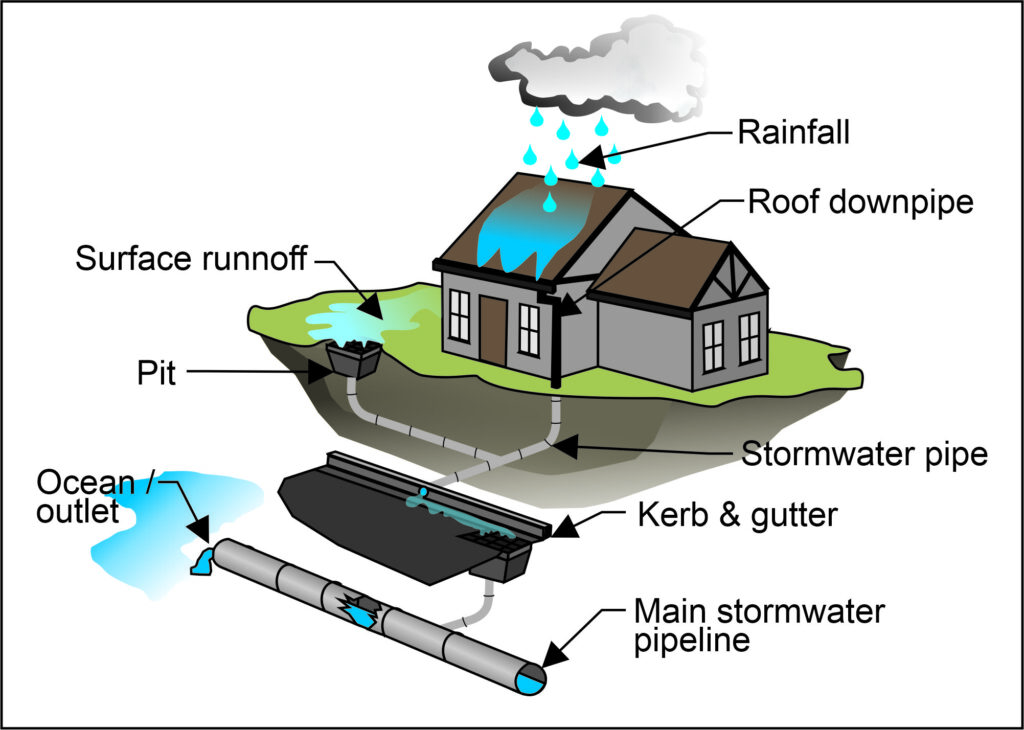
Integrated stormwater management reduces flood risk, protects infrastructure and ecosystems, and ensures safe urban development through smart planning and modelling.

Dennis Mulaudzi, hydrologist at SRK Consulting
Ponds and swales
 “Attenuation ponds – also called detention ponds – are commonly used for this purpose, as are sustainable drainage systems (SUDS) or artificial lakes called swales,” he said. “These structures help manage stormwater by holding excess water and gradually discharging it at a rate that represents pre-development conditions.”
This reduces strain on downstream drainage systems like pipes or channels, he pointed out. In terms of the stormwater policy guidelines and bylaws in cities like Johannesburg and Cape Town, stormwater discharge from a development must be controlled so that post-development peak flows do not exceed pre-development flows.
“This is critical in preventing increased flood risk to neighbouring properties and public infrastructure,” said Mulaudzi.
“Attenuation ponds – also called detention ponds – are commonly used for this purpose, as are sustainable drainage systems (SUDS) or artificial lakes called swales,” he said. “These structures help manage stormwater by holding excess water and gradually discharging it at a rate that represents pre-development conditions.”
This reduces strain on downstream drainage systems like pipes or channels, he pointed out. In terms of the stormwater policy guidelines and bylaws in cities like Johannesburg and Cape Town, stormwater discharge from a development must be controlled so that post-development peak flows do not exceed pre-development flows.
“This is critical in preventing increased flood risk to neighbouring properties and public infrastructure,” said Mulaudzi.

Floodlines
Another key aspect of stormwater management is determining floodlines, which indicate areas that are at risk of flooding under different storm conditions. Floodlines serve as regulatory boundaries that guide urban planning, infrastructure design and flood risk management.“In South Africa, the 1-in-50-year and 1-in-100-year floodlines are commonly used, representing the extent of flooding with a respective 2% and 1% probability of occurring in any given year,” he said.“These floodlines ensure that buildings, roads and other developments are constructed in safe locations, reducing the likelihood of flood damage.” Floodline studies also play a crucial role in environmental impact assessments (EIAs), water use licenses (WULs) and insurance assessments, ensuring compliance with national and municipal regulations.