Municipal infrastructure projects are often derailed due to insufficient attention given to the existing land rights and development restrictions at the feasibility stage.
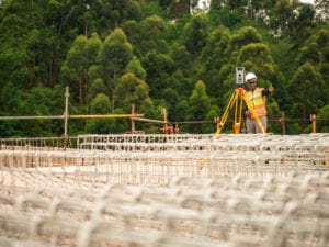
Craig Silva expands on the critical role geomatics professionals play in ensuring a successful service delivery outcome Technology has pervaded all facets of construction in the modern world, with surveying and the geomatics profession being no exception. Given the plethora of modern survey equipment and technologies available, it has become increasingly difficult for engineers to understand which survey method produces the correct accuracy for a given project. There is also a perception among clients requesting survey information that technological advancements have made surveys cheaper and faster, which is not the case. There are no shortcuts. As an expert in the field of spatial data, survey, cadastral and land ownership, geomatics professionals are responsible for drawing up the engineering and topographical surveys that other built environment team members depend on for project execution. For this reason, it’s vital that today’s engineers become conversant with the latest surveying technologies and understand the different accuracies that each can achieve. This will help them to identify and request the correct survey method to achieve the required information accuracies to successfully complete the project. The types of common technologies range from aerial mapping in the form of conventional aerial photography, lidar (new laser technology) and remotely piloted aircraft systems (RPAS or drones); conventional ground survey methods that use total stations and GPS; and lastly, the newer technology in the form of scanning entails both terrestrial and mobile scanning. A combination of the above technologies achieves a survey of base data that is sufficiently accurate for the design phase. It could also result in a quicker survey programme that is not unrealistic and offers considerable cost savings. However, a clear understanding of the mixed technologies and their respective accuracies is of the utmost importance to provide a cost-effective solution during each phase. Understanding the limitations of GIS information and the varying accuracy thereof is equally important when using Google Earth (and other free internet-based datasets) in conjunction with surveyed information. Land legal and the role of the geomatics professional When installing infrastructure, including bulk services, the project team needs to respect the ownership and rights of landowners within the project area. This is often overlooked or, if considered, left until the end of the design phase to tackle – often too late. Although a general rule is to find the shortest route, this is often not the most practical approach from a costing and sterilisation of land perspective. Crossing expensive land that has development rights can hold up theproject delivery from both a financial and practical viewpoint when it comes to dealing with the landowner.
Understanding the cadastral parcels, servitudes and restrictive conditions over the project area allows the land surveyor to advise the design team upfront on the best route in terms of land ownership scenarios. This advice includes the identification of high-valued properties, those where there is little chance of securing an agreement and deceased estates, which projects should avoid at all costs.
The land surveyor is well placed to advise, in conjunction with a conveyancer, what to include in the acquisition/servitude agreement. This should include items such as access rights while under construction, access rights for repairs of the infrastructure, working space outside the servitude (if required) and crop compensation. The geomatics professional is also well placed to provide assistance in the project management of the planning applications (SPLUMA applications and Act 70 of 70 applications)/consents, the valuations, signing of agreements, approval of any diagrams (servitude or subdivisional) and finally the registration thereof. To guarantee that a project starts on time and without delays from owners, it is critical for an agreement to be signed with the land owner and that, upon signing, access is granted for construction. The time frames to conclude the registration of rights can take some time and need to be managed constantly. Registration legislation of geomatics professionals The registration category of the geomatics professional is also important to understand in order to assess his competencies in the different areas of surveying. The enactment of a new Geomatics Profession Act (No. 19 of 2013) replaced the old Land Survey Act (No. 40 of 1984) dealing with the registration of surveyors and categories of competency. The new council for registration is known as the South Africa Geomatics Council and is an outcome of the Act. Failing to utilise the correctly registered professional geomatician exposes the project and client to adverse risk, which may be a liability in the form of financial costs and time delays. For those geomaticians who undertake drone work, statutory requirements to fly must be adhered to and the project teams must insist on proof of compliance. These include proof of an RPAS operator’s certificate and RPAS licence from the geomatician flying the project. Neither the survey company nor the surveyor may undertake work outside their registration category. For this reason, the geomatics profession remains highly disciplined and focused on achieving very precise outcomes. The process starts and ends with accurate data collection, analysis and mapping, and a clear understanding of property law andland ownership.


